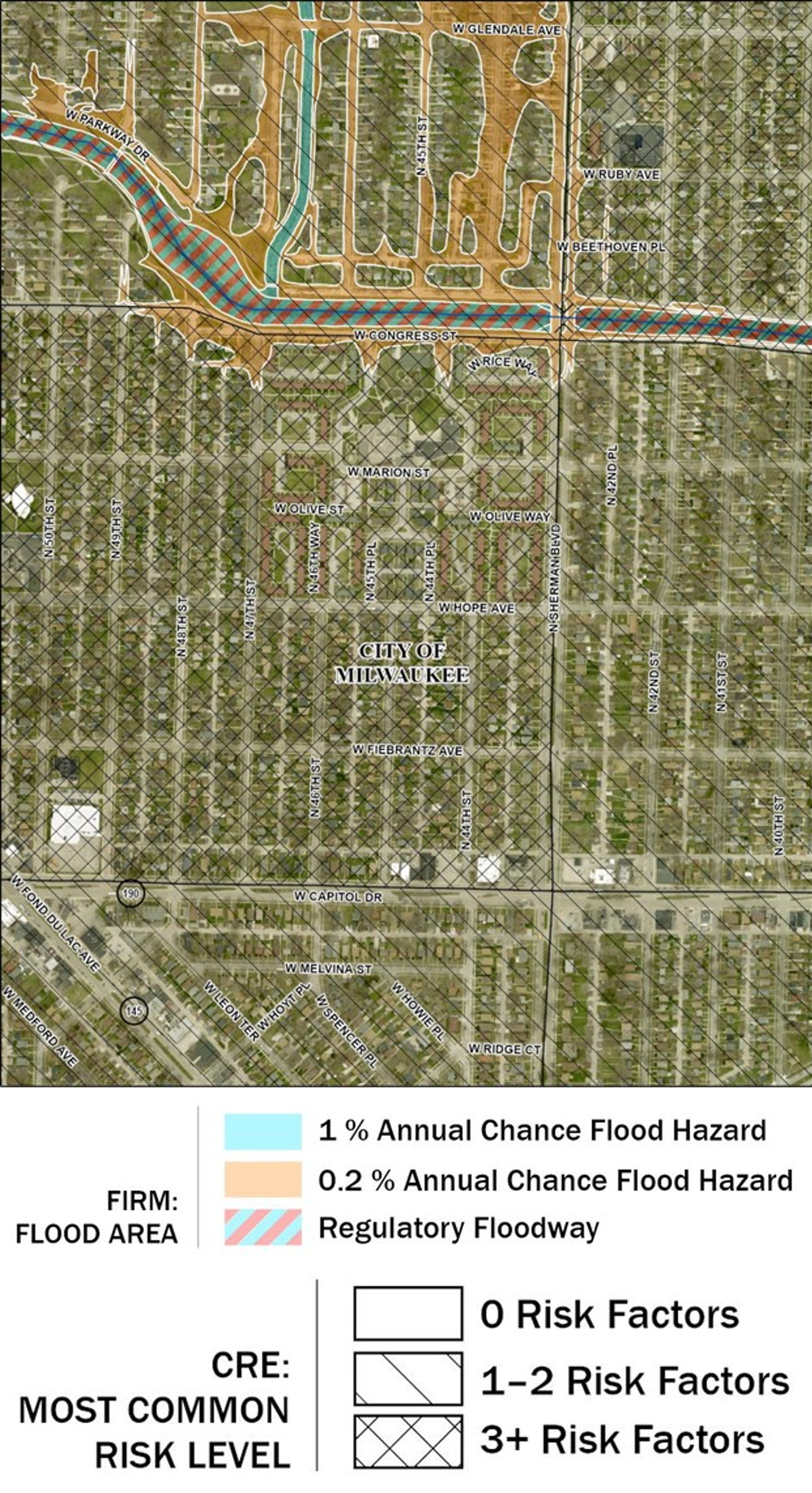
This is one of the figures from my Master’s thesis which I completed in 2024.
I wanted to test ways to improve flood risk communication using maps, mostly for public audiences. Although I came across different flood risk maps in my research, Flood Insurance Rate Maps (FIRMs) proved to be the most commonly used and well-known flood risk map in the United States. However, a lot of research demonstrates the limitations of FIRMs, so I narrowed my flood risk communication project to just FIRMs. They were already thoroughly critiqued and have to be used by tens of thousands of communities participating in the National Flood Insurance Program. My idea was that community government workers, for example, who might use FIRMs or probationary FIRMs to communicate with local residents could use different flood risk maps to communicate more effectively.
There are already many alternatives to FIRMs, and I personally think some of the model-based maps are the best overall. However, mapping is not only about being the most comprehensive or cutting-edge. An alternative map might serve a very specific purpose or have unique strengths or share a new perspective. This philosophy drove my work, since I could never compete with a nationwide flood risk model. What I could do was propose a flood risk map that is easy to replicate and has unique but relevant data. That is how I chose to work with Community Resilience Estimates data from the U.S. Census Bureau. It was a unique dataset that used microdata, updated annually, and was freely available. It was relevant because it depicted spatial, quantitative social vulnerability data. FIRMs do not explicitly depict flood vulnerability, so adding Community Resilience Estimates data can show which areas might be more impacted by a flood as a result of social risk factors.
I ended up making a few FIRMs myself, some with Community Resilience Estimates data and some without. I asked Milwaukee County residents to answer map task questions and share what they learned about flood risk from the maps. The results of the study show that this method has some potential to improve how FIRMs communicate flood risk.
