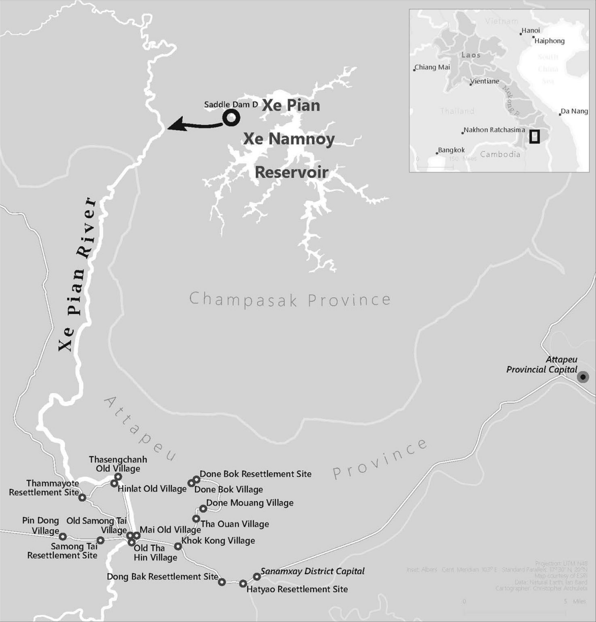
Ian Baird, a UW-Madison geogrpahy professor who specializes in studying Southeast Asia, wrote an article on the failure of an earthen dam in Laos. Click on the map to read the article. Baird's article, "Catastrophic and slow violence: thinking about the impacts of the Xe Pian Xe Namnoy dam in southern Laos", was published in The Journal of Peasant Studies on October 21, 2020. I worked on the above map in Summer 2019 as part of my first year of work in the UWCL.
Background
As a student cartographer at the UWCL, I make maps for lab clients. It is my job to communicate with clients about what they need from me and when. Usually, this involves discussions about user needs, design constraints, important deadlines, and feedback on my progress.
I worked with Ian Baird to make this map for his article about flooding that followed the collapse of the Xi Pian Xe Namnoy dam in Laos. The important mapped features included the location of the Xe Pian Xe Namnoy reservoir relative to the villages downstream, which experienced flooding after the dam collpase, and an inset map showing the area in the context of Laos and its neighboring countries.
Baird supplied me with the UTM coordinates of the affected villages. I translated these to latitude and longitude, and plotted them using ArcMap. Baird and I had to communicate a few times to make sure that I spelled the villages correctly. We also discussed the roads to include on the map, which Baird were familiar with. I manually traced them in Illustrator based on satellite imagery, aerial imagery, and maps based on their locations relative to the villages and natural features. I kept the map on a grayscale to accommodate for printing.
